X XFediYour place in the Fediverse
XFEDI

#GIS

ActivityPub

Public posts with this hashtag.

Open source does that? Wildfire evacuation, disaster response, 911 databases, flood intelligence, drone tree mapping, historical maps, precision farming, and more. FOSS4G NA, Nov 2–4, Sacramento.

Our guide to geo inspiration:
https://www.foss4gna.org/news-2026/open-source-does-that-talks-that-inspire
#GIS #OpenSource #Geospatial

FOSS4GNAOpen Source Does That? Talks that Inspire. — FOSS4G North AmericaInnovation and open source…this agenda is for the attendee who wants to see the surprising ways open source is being used to solve real-world problems. Follow open tools into wildfire evacuation, AI-powered disaster response, 911 addressing, supply chains, flood intelligence, historical maps, low-po
↩ Reply ♡ 0 · ↻ 0 ↗ Original

I often need to get mainland from country / administrative region polygons, so I finally decided to write a function to help automate it. Feedback welcome! https://modtools.wordpress.com/2026/10/20/get-largest-e-g-mainland-polygons-from-a-map/ #GIS #GISchat #Rstats #Rspatial #geospatial

modToolsGet largest (e.g. mainland) polygons from a mapI often need to get mainland from country / administrative region polygons, so I finally decided to write a function to help automate it. It selects the N largest feature(s) in a polygons or lines …
↩ Reply ♡ 0 · ↻ 0 ↗ Original

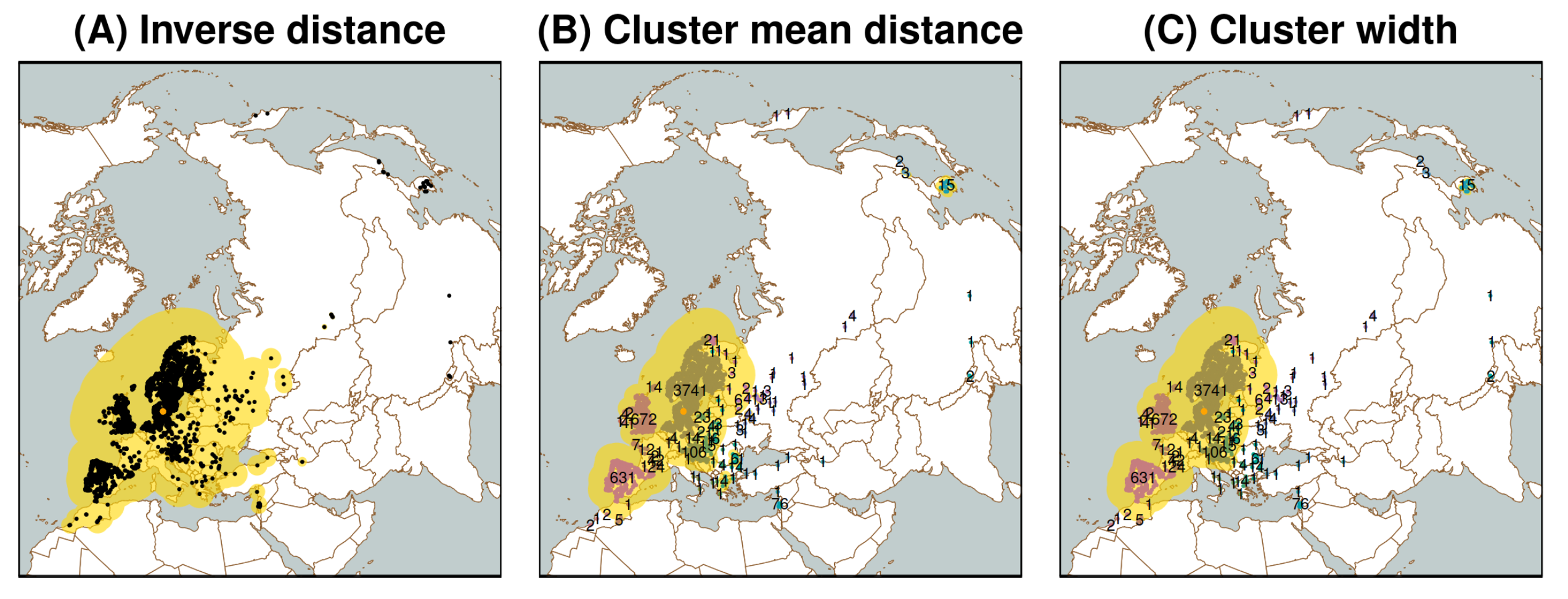
The paper introduces R algorithms that use data-driven, varying-size buffers to adaptively delimit background regions for SDM/ENM, with the aim of addressing spatially uneven sampling / survey bias: https://journals.ku.edu/jbi/article/view/25045 #Rstats #GISChat #GIS #biogeography #macroecology

Maps with spatially adaptive buffers around differently surveyed regions
journals.ku.eduSpatially adaptive background delimitation strategies for species distribution models with unevenly surveyed occurrences | Biodiversity Informatics
↩ Reply ♡ 0 · ↻ 0 ↗ Original

Our #GeoAI guide maps your path through FOSS4G NA, Nov 2–4 in Sacramento. Explore LLMs, spatial agents, MCP, embeddings, and knowledge graphs.

Which topic are you most curious about?

https://www.foss4gna.org/news-2026/explore-the-geoai-talks-at-foss4g
#Geospatial #EO #GIS #CNG

FOSS4GNAExplore the GeoAI talks at FOSS4G — FOSS4G North AmericaThis is a suggested agenda for attendees interested in GeoAI, large language models, spatial agents, machine learning, MCP, embeddings, knowledge graphs, and the infrastructure needed to make AI work with geospatial data.  Browse the full schedule and build your own path. And don’t
↩ Reply ♡ 0 · ↻ 0 ↗ Original